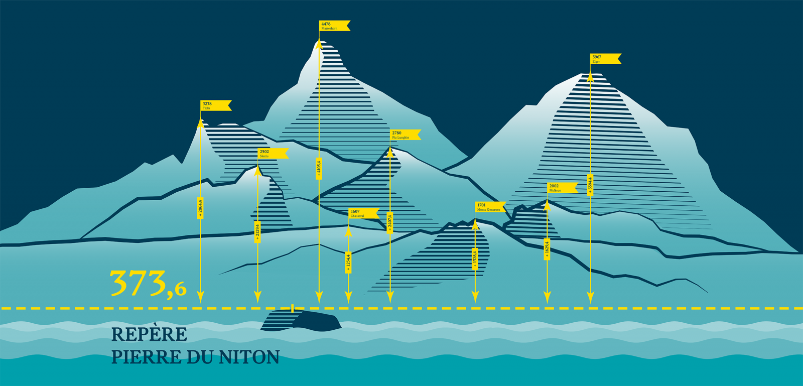
The starting point for Swiss height measurements
Height is usually measured in metres above sea level. Because Switzerland is a landlocked country and cannot be measured from the sea, it needs a reference point for its height system. In the 19th century, French measurements were used for this purpose. In the first instance, the height of the signal on the Chasseral was used. Later, a reference point for the Swiss height system was placed on the Pierres du Niton in Lake Geneva’s basin – the “Repère Pierre du Niton” (Pierre du Niton marker). Its actual height is based on measurements from the Mediterranean Sea in Marseille.
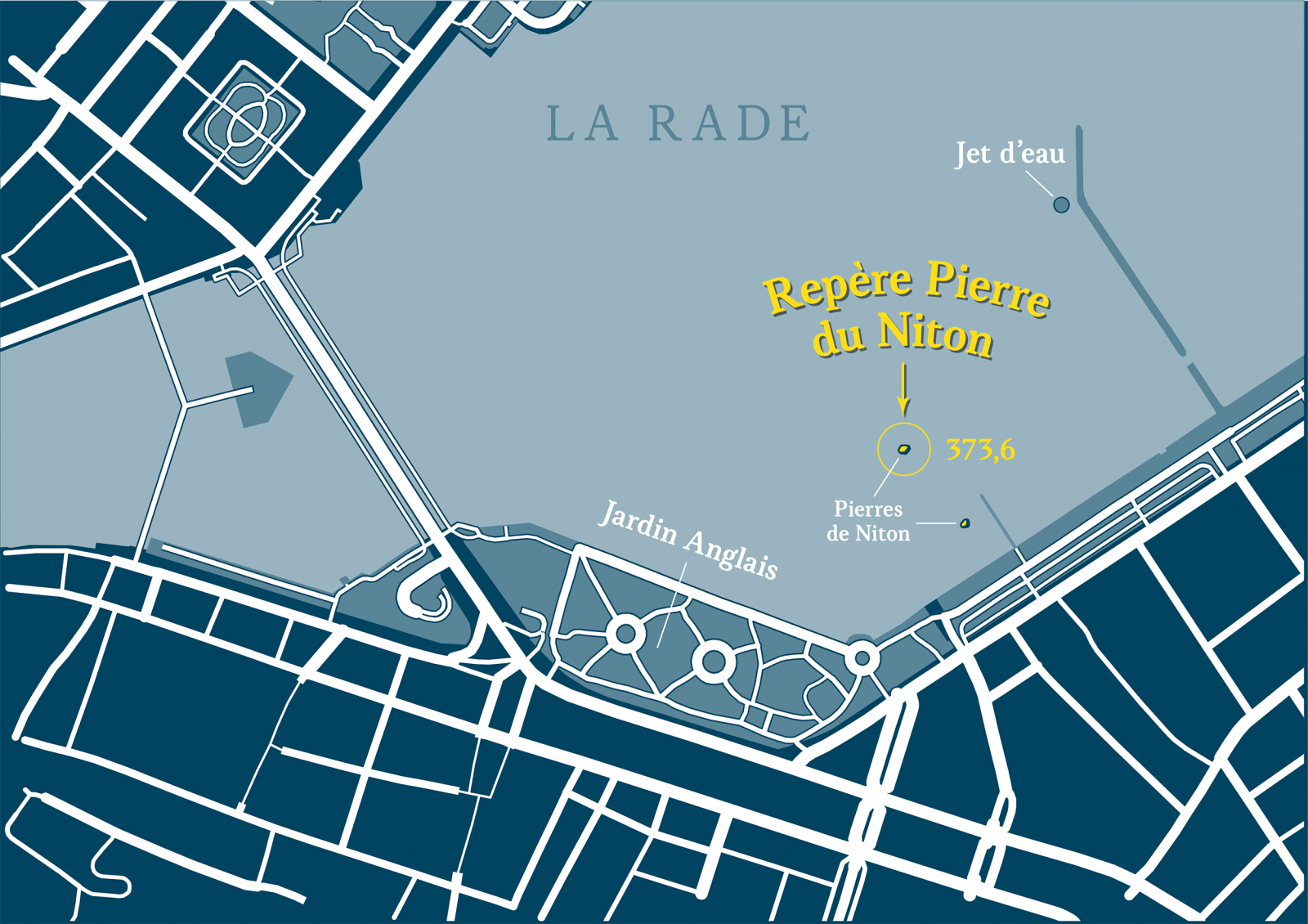
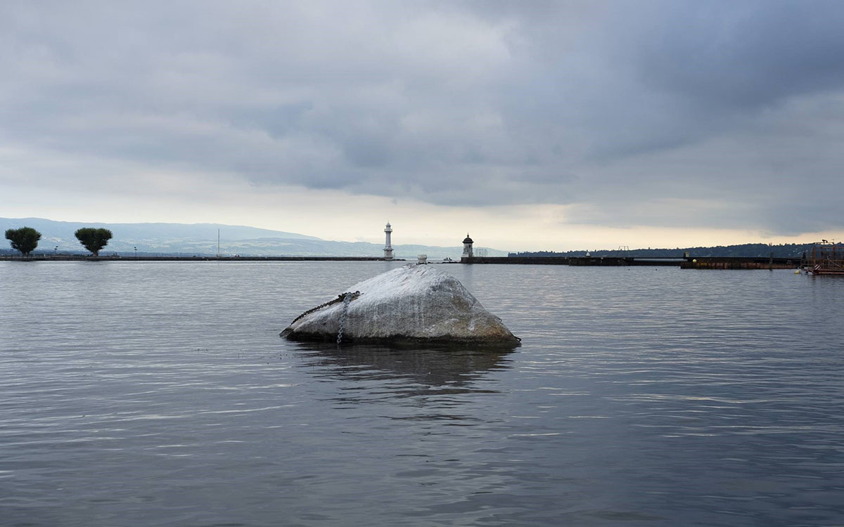
The Pierre du Niton marker can be found on the smaller granite boulder in the basin, further away from the shore and close to the landing stages. The stone is clearly visible from the shore and you can take a boat trip that goes directly past it.
Videos
Height above sea level as a common reference level
Everyone perceives units of measurement differently, whether it be time, distance, weight or height. For society to function, measuring systems are therefore required that we can use to compare different values. Height is a special case here because, for a long time, it was not possible to measure height directly; rather, a map containing heights was needed as a reference.
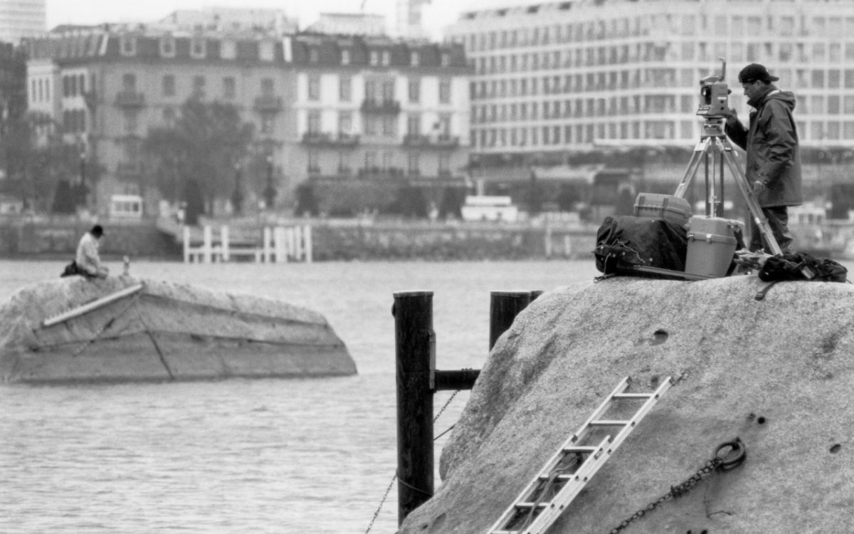
Determining the height of the Pierre du Niton marker
Height is measured in metres above sea level. Because Switzerland is a landlocked country, French measurements from Marseille to Geneva were used in the 19th century. As part of this, a reference point was placed on the Pierres du Niton in Lake Geneva’s basin – the “Repère Pierre du Niton” (Pierre du Niton marker). All heights measured in Switzerland are based on this starting point.
The international coordination of heights
Sea level is not constant as a starting point for each height measurement. In Europe, each country therefore determined heights from its own measurement of sea level. This resulted in discrepancies within the height system. Over time, the aim was therefore to standardise the differing land heights in order to facilitate international cooperation. Even today, however, there are still height differences in the decimetre range at common points at national borders.
New technical possibilities and challenges
Satellite navigation devices have made measuring height easier since around 2000. They enable sea level to be determined directly at any given position. However, satellite navigation devices do not work independently, but as part of a complex technical system. Numerous factors have to work together to ensure that height measurement is correct.
News
The height stone
The Swiss Pierre du Niton reference height point in the Lake Geneva basin has an eventful history. How did the Pierre du Niton evolve from a rock surrounded by water to the authoritative height mark in Switzerland?
From a distance, they look like the backs of whales, rising above the water, but up close, the two objects in Lake Geneva’s basin are revealed to be grey boulders. The Pierre du Niton and Pierre Dyolin are fixed landmarks in Geneva’s cityscape; their pronounced appearance in shallow water provides a natural orientation point...
Press release
Pierre du Niton marker: how the altitude measurement in Switzerland started from Geneva
On the occasion of the bicentenary of the Pierre du Niton marker in Geneva, the Federal Office of Topography swisstopo and the Department of Territorial Development of the Republic and Canton of Geneva present to the public the history and current challenges of altitude measurement in Switzerland and around the world.
In the 19th century, the reference point of the Swiss height measurement system was defined at the level of the Pierres du Niton in Lake Geneva's basin: the "Repère Pierre du Niton". It is from this reference point that all other altitude points in Switzerland were measured and recorded on the national maps...
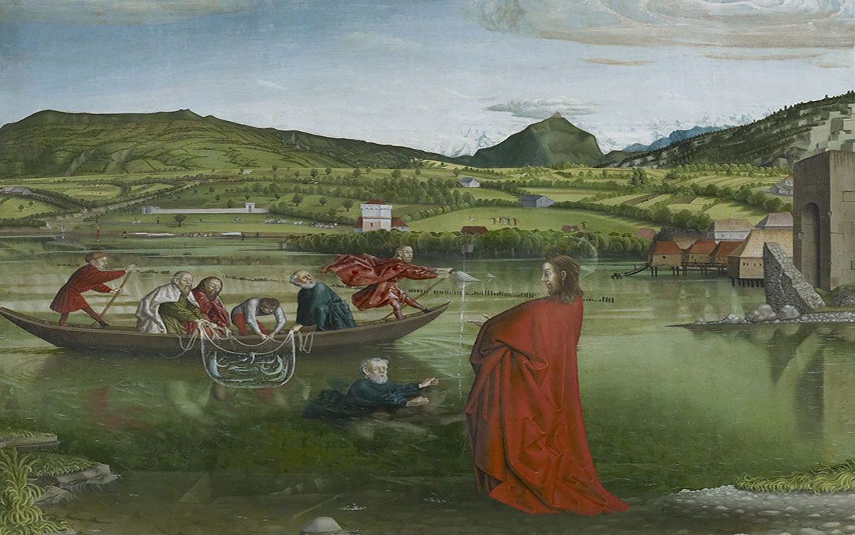
The Pierre du Niton in 1444
The two Pierres du Niton are clearly visible in "The Miraculous Draft of Fishes", a work by the Swiss painter Konrad Witz dated 1444. It is one of the first realistic representations of a landscape in painting.
At that time, the smaller Pierre du Niton was not yet the starting point for Swiss height measurements, but the stones already marked the city's urban landscape, which was to be identified on this altarpiece in St. Peter's Cathedral.
Discover "The Miraculous Draft of Fishes" by Konrad Witz at the Geneva Museum of Art and History...
Partner
Le canton de Genève et l’Office fédéral de topographie swisstopo proposent des informations et différentes activités autour du repère de la Pierre du Niton.
Contact
Adresse
Rue de l'Hôtel-de-Ville 14
1204 Genève
Suisse Tél: +41 22 327 94 00